Geography
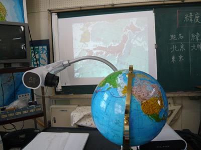
Primary School – Japan
The lesson objective: To learn how to read a Globe and to understand how to read longitude and latitude on the globe.
The visualiser was used to investigate the globe. Change the angle of the visualiser’s head and arm to see sides of the globe. By enlarge the actual globe the students can easily understand what is longitude and latitude on the globe. And it is very easy to indicate the countries we are looking for on the globe.
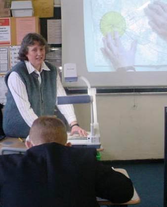
Sandon High School – UK
The lesson objective: Teaching Ordnance Survey Map Reading skills.
How the visualiser was used: Pupils were taught 4 and 6 figure grid references using grids projected onto the whiteboard. Pupils then came out in turn to plot grid references. Pupils were asked orally for grid references from the resource. To then transfer this skill to using the Free Ordnance Survey Maps for Schools, in the case of Sandon High School. 1:25 000 Stoke-on-Trent, provided for every Year 7. The sections of the Ordnance Survey map was projected onto the screen and used to set the task and ensure pupils are looking at the correct section of the map and symbols. (The Department does have the software Memory Map and uses this for different parts of Britain and the facility to create 3Dmaps and photographs of the relief features. However on Memory Map the easting and northings are not always shown).